Introduction
As technology advances, the integration of Geographic Information Systems (GIS) into emergency response operations has become increasingly vital. One of the most significant advancements in this field is the development of indoor GIS map layers. These detailed maps provide crucial information about the interior layouts of buildings, enhancing the capabilities of police, fire, and 911 call software that rely on GIS mapping. This blog post explores how indoor GIS map layers are compatible with these systems and the benefits they offer.
The Role of GIS in Emergency Response
GIS technology allows emergency services to visualize, analyze, and interpret data to understand spatial relationships and patterns. Traditional GIS maps have focused on outdoor environments, providing critical information such as road networks, terrain, and infrastructure. However, emergencies often occur indoors, where detailed interior maps are crucial for effective response.
Indoor GIS Map Layers
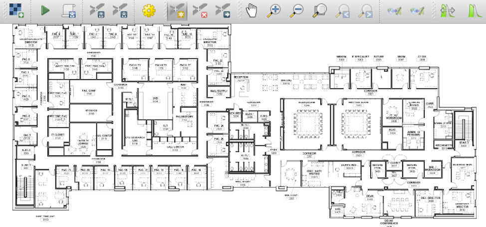
Indoor GIS map layers provide detailed information about the interior of buildings, including floor plans, room layouts, stairwells, exits, and critical infrastructure like fire alarms and sprinkler systems. These maps are created using various technologies, such as:
- LiDAR (Light Detection and Ranging)
- Building Information Modeling (BIM)
- Manual Surveying and CAD Drawings
Compatibility with Police, Fire, and 911 Call Software
- Police Software Integration
- Tactical Planning: Indoor GIS maps enable police to plan tactical entries and evacuations more effectively by providing detailed building layouts. This is particularly useful in active shooter situations or hostage scenarios.
- Real-Time Navigation: Officers can use these maps for real-time navigation within complex buildings, reducing response times and enhancing situational awareness.
- Asset Management: Information about security cameras, alarms, and other security measures within the building can be integrated into the GIS system, aiding in surveillance and crime prevention.
- Fire Department Software Integration
- Incident Command: Fire incident commanders can use indoor GIS maps to coordinate firefighting efforts, locate hazards, and plan evacuation routes.
- Search and Rescue: Detailed maps of building interiors help firefighters navigate through smoke-filled or poorly lit areas to locate and rescue individuals more efficiently.
- Resource Allocation: Fire departments can better allocate resources by understanding the layout and critical points within a building, such as water sources and fire alarm panels.
- 911 Call Center Software Integration
- Caller Location: Indoor GIS maps enhance the ability of 911 operators to pinpoint the exact location of a caller within a building, improving the accuracy of emergency response.
- Dispatch Efficiency: Operators can relay detailed information about the building layout to first responders, ensuring they are better prepared upon arrival.
- Incident Tracking: Indoor GIS maps allow for better tracking and management of incidents within large or multi-story buildings, facilitating coordinated responses from multiple agencies.
Benefits of Integrating Indoor GIS Maps
- Improved Response Times: Detailed indoor maps reduce the time it takes for emergency responders to navigate unfamiliar buildings, leading to faster and more effective interventions.
- Enhanced Situational Awareness: First responders have access to comprehensive building layouts, improving their understanding of the environment and potential hazards.
- Better Coordination: Indoor GIS maps facilitate better communication and coordination between different emergency services, ensuring a unified response to emergencies.
- Increased Safety: By providing critical information about building interiors, indoor GIS maps help protect the lives of both emergency responders and the individuals they are rescuing.
The integration of indoor GIS map layers into police, fire, and 911 call software represents a significant advancement in emergency response technology. By providing detailed and accurate information about building interiors, these maps enhance the capabilities of emergency services, leading to faster response times, better coordination, and ultimately, saved lives. As technology continues to evolve, the use of indoor GIS mapping will undoubtedly become an essential component of modern emergency management.
